Humidity, Dew Point and Fog
MeteorologyWhat humidity and the dew point are, how to find the dew point with the wet and dry bulb, and how advection (sea) fog and radiation (land) fog form and clear. Predicting fog from the sea temperature keeps you ahead of restricted visibility, and it is a regular MCA oral question.
Last reviewed 1 Nov 2026 · From a professional captain's years of study notes · Organised with AI and checked against current regulations · How we write
On this page (9)
Humidity and relative humidity
In short: air always carries some invisible water vapour. Warm air can hold more of it than cold air.
Read first: Pressure, Wind and the Coriolis Effect (topic 1 of Meteorology). This is topic 2. Next: Depressions, Fronts and Synoptic Charts. The wet and dry bulb hygrometer itself is covered in Weather Instruments and Observations.
- Humidity = the amount of water vapour in the air. You cannot see vapour; you only see it once it condenses into droplets.
- How much vapour air can hold depends on its temperature: the warmer the air, the more it can hold.
- Relative humidity (RH) = the vapour the air actually holds, as a % of the most it could hold at that temperature.
- 100% RH = the air is saturated. It cannot take any more vapour.
- Key idea: you do not need to add water to saturate air. Cooling it is enough: the same vapour in colder air gives a higher RH, until it reaches 100%.
The dew point
In short: the dew point is the temperature at which the air becomes saturated. Cool the air below it and water appears.
- Dew point = the temperature to which air must be cooled, with no change in its vapour, to become saturated.
- Cooled below the dew point, the extra vapour condenses into droplets: dew on the deck, cloud aloft, or fog at the surface.
- The closer the air temperature is to the dew point, the moister the air and the less cooling it takes to form fog.
- Exam wording: say “the temperature at which air becomes saturated”. Do not say “the point at which air becomes water”.
Finding the dew point: wet and dry bulb
- The dry bulb is an ordinary thermometer: it gives the air temperature.
- The wet bulb is kept wet. Water evaporates from it and cools it, so it reads lower. The drier the air, the more evaporation and the bigger the gap.
- Wet-bulb depression = dry-bulb reading minus wet-bulb reading.
- Enter the hygrometric table with the dry-bulb temperature and the depression. It gives the dew point (and the relative humidity). The table is in NP100 (The Mariner’s Handbook) or the Marine Observer’s Handbook.
- Small depression = air close to saturation. Zero depression = saturated air.
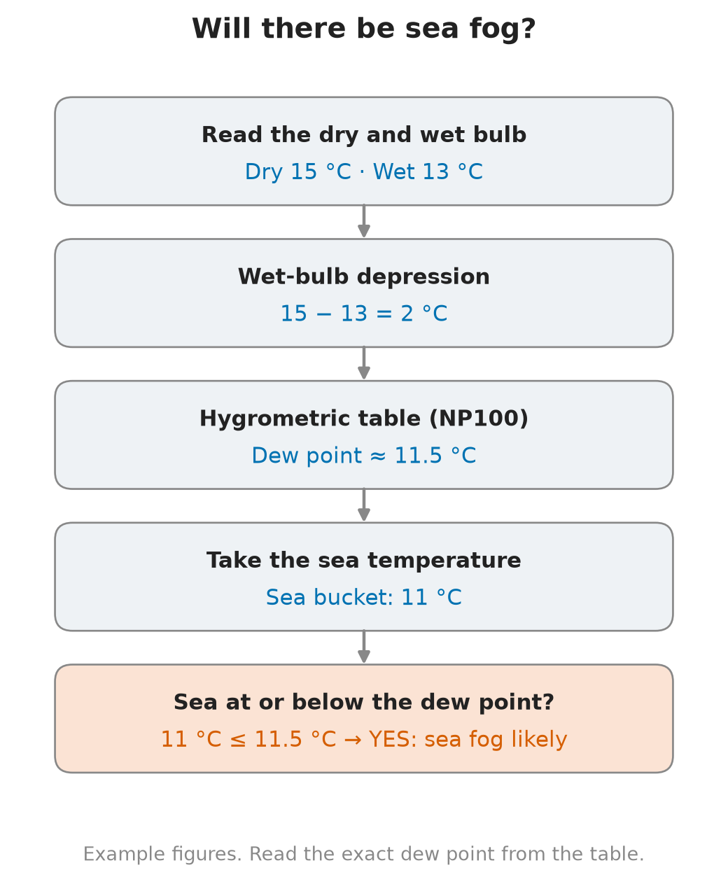
- Example: dry bulb 15 °C, wet bulb 13 °C → depression 2 °C → dew point about 11.5 °C (read the exact figure from the table).
What fog is
In short: fog is a cloud sitting on the surface. By definition it cuts visibility to less than 1000 m.
- Fog = tiny water droplets suspended in the air at the surface, reducing visibility to less than 1000 m (Met Office).
- If visibility is 1000 m or more, it is mist (droplets) or haze (dry particles), not fog.
- Fog forms when air near the surface is cooled to its dew point. At sea and on the coast, the two types to know are advection (sea) fog and radiation (land) fog.
- On the bridge: fog means restricted visibility under COLREG. That changes your duties: see the last section below.
Advection (sea) fog
In short: warm, moist air drifts over a colder sea, cools to its dew point and turns to fog. This is the fog that matters most at sea.
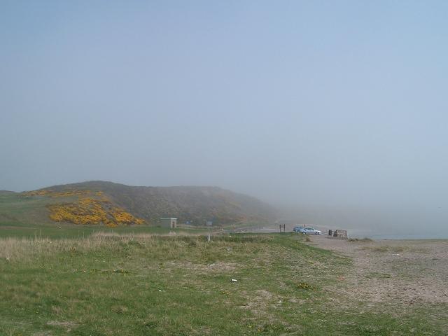
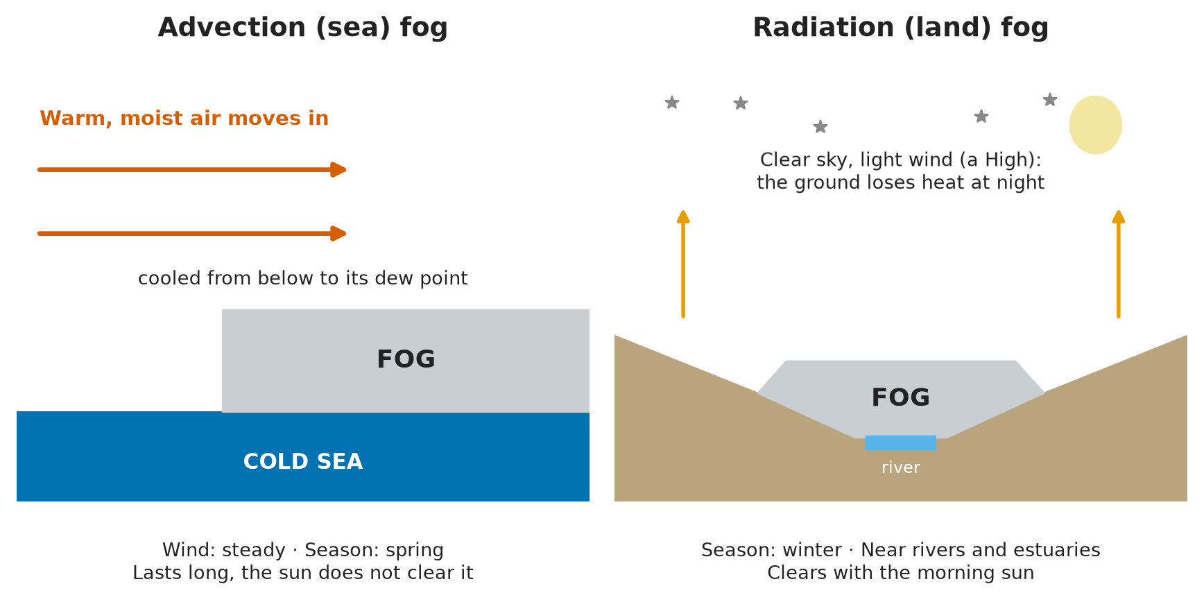
- How it forms: warm, moist air moves (is “advected”) over a colder surface, usually a cold sea. The sea cools the air from below until it reaches its dew point.
- It is the most dangerous fog for shipping: it forms over open water and can cover a wide area.
- It can form with a steady wind: the wind is what carries the warm air over the cold water.
- When: mostly in spring, when the air is warming but the sea is still cold after winter. In the UK it is frequent in March.
- How long: it is persistent and can last a long time. The sun does not clear it, because the sea temperature hardly changes between night and day. It usually clears only when the wind or the air mass changes.
- On the bridge: warm, humid air blowing towards colder water (a cold current, or a sea still cold in spring) is the warning sign. Check the sea temperature against the dew point.
Radiation (land) fog
In short: on a clear, quiet night the ground cools, chills the air above it to the dew point, and fog forms over land.
- How it forms: at night, under high pressure (clear skies, light winds), the ground loses heat. The air touching the ground cools with it. If it falls to its dew point, radiation fog forms.
- When: typical in winter, when nights are long.
- Where: over land, often in valleys and near rivers such as the Thames. It can drift out over rivers, estuaries and harbours.
- How long: less persistent than sea fog. It normally clears with the sun, as the ground warms during the morning.
- On the bridge: expect it when entering or leaving a river port at night or early morning in winter, under a High.
Advection fog vs radiation fog
| Advection (sea) fog | Radiation (land) fog | |
|---|---|---|
| Cause | Warm, moist air over a colder sea | Ground cools at night and chills the air above |
| Where | At sea, over a wide area | Over land, near rivers (e.g. the Thames), drifting into estuaries |
| Weather | Can form with a steady wind | Night, high pressure, clear sky, light wind |
| Season | Mostly spring (UK: often March) | Mostly winter |
| How long | Persistent, can last a long time | Less persistent, clears with the sun |
| Danger at sea | Most dangerous | Mainly in rivers and harbour approaches |
Predicting fog at sea
In short: find the dew point and compare it with the sea temperature. Sea at or below the dew point = sea fog likely.
The sea temperature test
- Read the dry and wet bulb and work out the wet-bulb depression.
- Get the dew point from the table in NP100 or the Marine Observer’s Handbook.
- Take the sea temperature.
- If the sea temperature is equal to or lower than the dew point, the air in contact with the sea will cool to saturation: sea fog is likely (NP100).
- Example: dew point about 11.5 °C, sea temperature 11 °C → the sea is below the dew point → expect sea fog.
- Other sign: dry and wet bulb readings close together mean the air is nearly saturated, so fog is likely.
- Repeat the readings regularly: a shrinking gap between dew point and sea temperature is your early warning.
On the bridge when fog is likely
- Call the Master as the standing orders require, and tell the engine room: engines ready for immediate manoeuvre (COLREG Rule 19(b)).
- Proceed at a safe speed for the visibility (COLREG Rule 6).
- Keep a proper lookout by sight, hearing and radar (COLREG Rule 5). Use radar plotting or ARPA for every target (COLREG Rule 7).
- Start fog signals: a power-driven vessel making way sounds one prolonged blast at intervals of not more than 2 min (COLREG Rule 35).
- Switch on the navigation lights (COLREG Rule 20) and fix the position often.
⚡ Flashcards
Test yourself, one card at a timeQ1What is relative humidity?
AnswerHow much water vapour the air holds, as a % of the most it could hold at that temperature. 100% = saturated.
Common trapCool the same air and its relative humidity rises, even though no water was added.
Q2What is the dew point?
AnswerThe temperature at which air becomes saturated. Cool the air below it and the vapour condenses: dew, cloud or fog.
Common trapIt is a temperature, not “the point where air turns into water”.
Q3How do you find the dew point on board?
AnswerRead the dry bulb and wet bulb. Dry minus wet = wet-bulb depression. Enter the table in NP100 or the Marine Observer’s Handbook to get the dew point. Small depression = air close to saturation.
Q4What is fog?
AnswerWater droplets at the surface that cut visibility to less than 1000 m: a cloud at sea level.
Common trapVisibility of 1000 m or more is mist or haze, not fog.
Q5How does advection (sea) fog form?
AnswerWarm, moist air moves over a colder sea and is cooled to its dew point. It is the most dangerous fog for ships.
Common trapIt does not need calm: the wind is what brings the warm air in.
Q6When is sea fog most likely, and how long does it last?
AnswerMostly in spring, while the sea is still cold (in the UK, often March). Persistent: it can last a long time, and the sun does not burn it off.
Q7How does radiation (land) fog form?
AnswerA clear night under high pressure: the ground loses heat, cools the air above it to the dew point. Typical in winter. At sea you meet it near rivers and estuaries (e.g. the Thames), when it drifts out.
Q8Radiation fog or advection fog: which clears first?
AnswerRadiation fog: less persistent, it normally clears as the sun warms the ground.
Common trapDo not expect sea fog to clear at sunrise: the sea temperature hardly changes from night to day.
Q9How do you predict sea fog?
AnswerFind the dew point from the table. If the sea temperature is at or below the dew point, sea fog is likely (NP100).
Common trapCompare the dew point with the sea temperature, not the air temperature.
Q10The wet and dry bulb readings are close together. What does it mean?
AnswerThe air is nearly saturated: fog is likely. Tell the Master and get ready for restricted visibility.
📚 Resources
Videos
- The 7 Types of Fog Every Pilot Should Know — Pilot Institute Airplanes (aviation angle, but radiation and advection fog are explained the same way)
Books
- NP100 The Mariner’s Handbook — UK Hydrographic Office (ADMIRALTY), current edition: meteorology chapter, hygrometric (dew point) table, sea fog
- Marine Observer’s Handbook — Met Office, 11th edition (1995): wet and dry bulb observations and dew point tables
Regulations
- COLREG 1972 — IMO: COLREG Rule 5 (lookout), Rule 6 (safe speed), Rule 19 (conduct in restricted visibility), Rule 35 (sound signals in restricted visibility)
Official sites
- What is fog? — Met Office
- Admiralty Mariner’s Handbook (NP100) — UK Hydrographic Office
Exam focus — MCA
Typical questions • “What is the dew point?” → the temperature at which air becomes saturated; cooled below it, the vapour condenses. • “How do you find the dew point on board?” → dry bulb minus wet bulb = wet-bulb depression; enter the table in NP100 or the Marine Observer’s Handbook. • “How would you predict sea fog?” → sea temperature at or below the dew point = sea fog likely (NP100); wet and dry bulb close together = air nearly saturated, fog likely. • “What is the difference between advection and radiation fog?” → advection: warm moist air over a colder sea, most dangerous, persistent, mostly spring; radiation: land, clear night under high pressure, winter, near rivers like the Thames, clears with the sun. • “Fog is forecast on your watch. What do you do?” → call the Master, safe speed, lookout and radar, engines ready, fog signals (COLREG Rules 5, 6, 19, 35). What examiners look for: the correct definition of dew point (a temperature, saturation), fog under 1000 m, the sea-temperature test with NP100 named, and a quick link from the forecast to bridge actions in restricted visibility.